For generations, oil exploration was a high-stakes gamble. It blended science with a dash of folklore. The legendary “Doodlebugger,” with their almost mystical ability to find oil, was a symbol of this era. Today, that era is over. A technological seismic shift is reshaping the landscape. It is making discovery more science than sorcery. At the forefront of this revolution is Hyperspectral Imaging. This technology is not just an upgrade. It is a complete paradigm shift for explorers and investors alike.
What is Hyperspectral Imaging? Seeing the Invisible
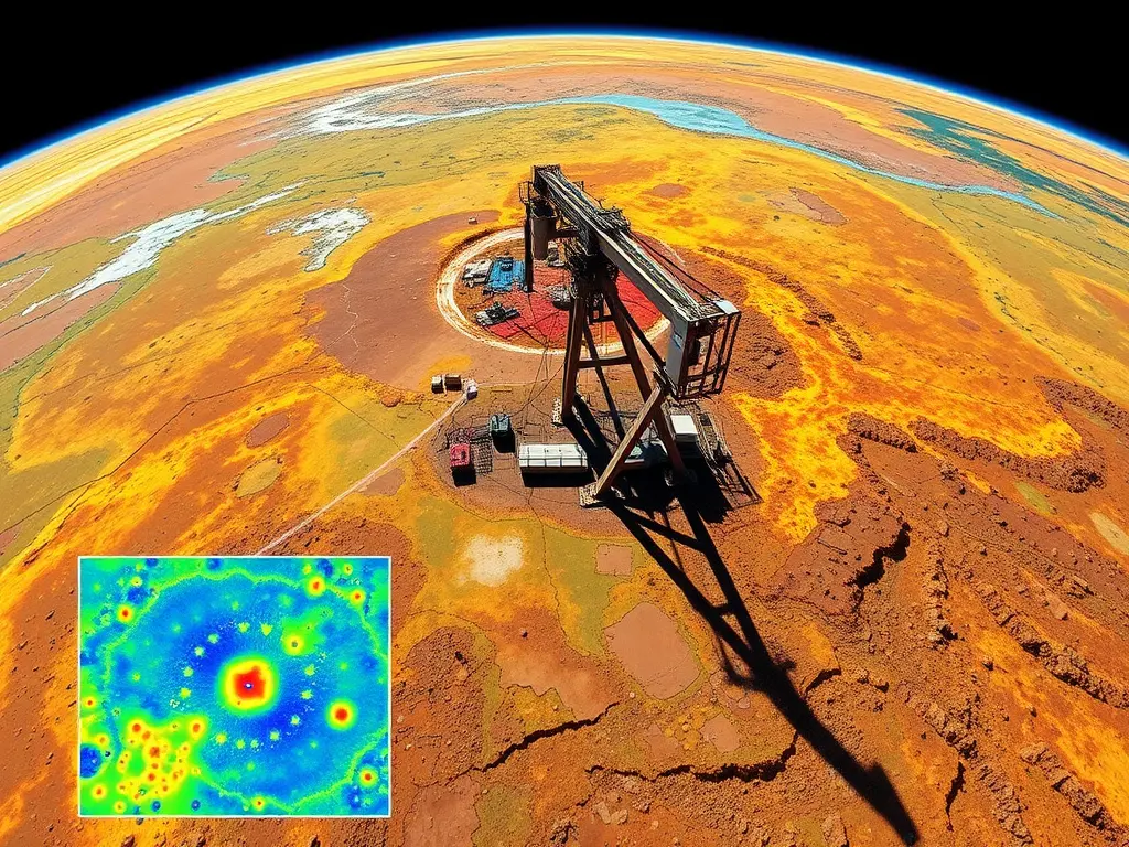
Let’s break down this complex-sounding term. Imagine traditional satellite imagery is a standard box of 8 crayons. It sees the world in broad, basic colors. Now, imagine Hyperspectral Imaging as a colossal box of 500 crayons. Each crayon represents a sliver of the light spectrum. This includes wavelengths invisible to the human eye.
This technology scans the Earth’s surface from satellites or aircraft. It captures hundreds of images at different wavelengths. Each pixel in these images contains a unique chemical fingerprint. It can reveal the presence of specific elements and compounds. This includes hydrocarbons that have seeped to the surface over millennia. It essentially makes the invisible, visible.
- How does it work in practice? The sensor detects subtle spectral signatures. For example, certain clay minerals altered by hydrocarbon micro-seeps have a very specific signature. Hyperspectral Imaging identifies these “halos” of alteration. They are clear indicators of a potential reservoir below.
Why Hyperspectral Imaging is a Game-Changer for Oil Exploration
The oil and gas industry is notoriously capital-intensive. For decades, technological advantages were the exclusive domain of supermajors. Smaller, independent explorers were left relying on outdated maps and intuition. This has fundamentally changed.
The primary reason? Accessibility. The cost of deploying Hyperspectral Imaging has plummeted. This is thanks to advancements in satellite technology and data processing. According to 2025 market analyses, the global hyperspectral imaging market in oil and gas is projected to grow by over 18% annually. This growth is fueled by its proven success rate. It democratizes high-level exploration.
Key Benefits for Modern Explorers:
- Reduced Risk: It moves exploration from guesswork to data-driven decision-making.
- Cost Efficiency: It dramatically narrows the target area. This saves millions on unnecessary seismic surveys and dry wells.
- Speed: Large areas can be scanned and analyzed in weeks藩 not months.
- Level Playing Field: Independents can now compete with the technical prowess of large corporations.
A Success Story You Can Trust: The Quickstrike Blueprint
Consider the real-world example of Quickstrike in West Virginia. In partnership with Geo-Max Exploration, they integrated Hyperspectral Imaging into their workflow. Leaders Pete Hall and Jack Vires have been transparent about their process. They combined this high-tech data with traditional geochemical analysis.
Their family-run approach emphasizes relationships and verifiable results. This isn’t a speculative story. It’s a documented methodology. Their track record of successfully locating new reserves proves the power of this integrated approach. They are a living case study. They show how Hyperspectral Imaging delivers a tangible return on investment.
The Step-by-Step Workflow: How We Use Hyperspectral Imaging at Dynamic Natural Resources
At our operations with Hughes Energy in Illinois, we’ve built a robust, multi-layered process. It is designed for maximum confidence. Here’s how we will implement it in our upcoming projects:
- The 2×2-Mile Snapshot: The Broad Scan
We first acquire a broad Hyperspectral Imaging dataset. This gives us a macro view of the area. It immediately highlights surface “hotspots.” These are potential hydrocarbon seepage zones. This initial step is our strategic guide. - Side-Looking Airborne Radar: Mapping the Pathways
Once we have our hotspots, we deploy radar. This technology maps sub-surface fractures and faults. These geological features are the natural pathways for oil migration. Combining seepage data with fracture maps pinpoints the most probable accumulation points. - Geochemical Confirmation: Ground-Truthing the Data
Technology is brilliant, but physical proof is paramount. We conduct a thorough geochemical analysis. Hydrocarbons seeping to the surface alter the soil chemistry. They foster unique bacterial communities. We take soil samples to detect these changes. This confirms what the imagery suggests. - Iodine and Gas Analysis: The Final Validation
Iodine is a key marker. It is often found in high concentrations above oil and gas reservoirs. We test for iodine anomalies. We also measure soil gas for methane, pentane, and butane. High readings here are the final piece of the puzzle. They give us the green light.
Comparison: Old Way vs. New Way
| Feature | Traditional Exploration | Hyperspectral-Driven Exploration |
|---|---|---|
| Primary Tool | Seismic surveys, geological maps | Hyperspectral Imaging, radar, geochemistry |
| Data Source | Sub-surface sound waves, historical data | Surface chemical fingerprints, precise fracture maps |
| Risk Level | High (significant guesswork) | Managed and significantly reduced |
| Cost Profile | High upfront capital with high dry-hole risk | Targeted spending based on verified data |
| Time to Target | Months to years | Weeks to months |
| Accessibility | Mostly large corporations | Accessible to agile independents |
The Investor’s Psychology: Turning Fear into Confidence
Let’s address the human element. Oil investment can be intimidating. The fear of a “dry hole” looms large. This fear is rooted in a lack of control and transparent information. Hyperspectral Imaging directly addresses this psychological barrier.
- From Intuition to Information: Investors are no longer betting on a charismatic “Doodlebugger.” They are investing in a verifiable, data-backed process.
- Reducing Cognitive Bias: The clear, multi-layered data helps overcome the “gambler’s fallacy.” It replaces hope with evidence.
- Building Trust: Transparency in the methodology fosters a stronger investor-company relationship. When you can see the steps, you believe in the outcome.
This technology provides a narrative of control. It tells investors, “We have done our homework. We have mapped the clues. We have confirmed the signal.” This is incredibly powerful. It transforms a speculative venture into a strategic investment.
Your Path to Participation: How to Get Involved and Win
The future of oil exploration is transparent, efficient, and data-rich. The question is no longer if you should invest, but how to align yourself with the right operators. You too can be part of this winning strategy.
What should you look for in a company?
- Technological Adoption: Prioritize companies that openly discuss their use of Hyperspectral Imaging and geochemical analysis.
- Proven Workflow: Look for a clear, explained process. It should move from broad scanning to ground confirmation.
- Transparency: Leadership should communicate their methods and results clearly. They should build trust, as seen in the Quickstrike model.
- Track Record: A history of successful projects using these technologies is the strongest social proof.
The barriers have fallen. The tools are available. The success stories are being written now. Hyperspectral Imaging is the key that unlocks value for explorers and investors. It provides a level of certainty previously unimaginable. This is your chance to move with the market.
Do not let this revolution pass you by. The data is clear. The technology is proven. The opportunity is now. Align yourself with innovators. Leverage the power of Hyperspectral Imaging. You can confidently participate in the next great oil discovery. The rewards await those who embrace this new, smarter path.